
photos
honeymoon
to do
|
home photos honeymoon to do |
| Our honeymoon |
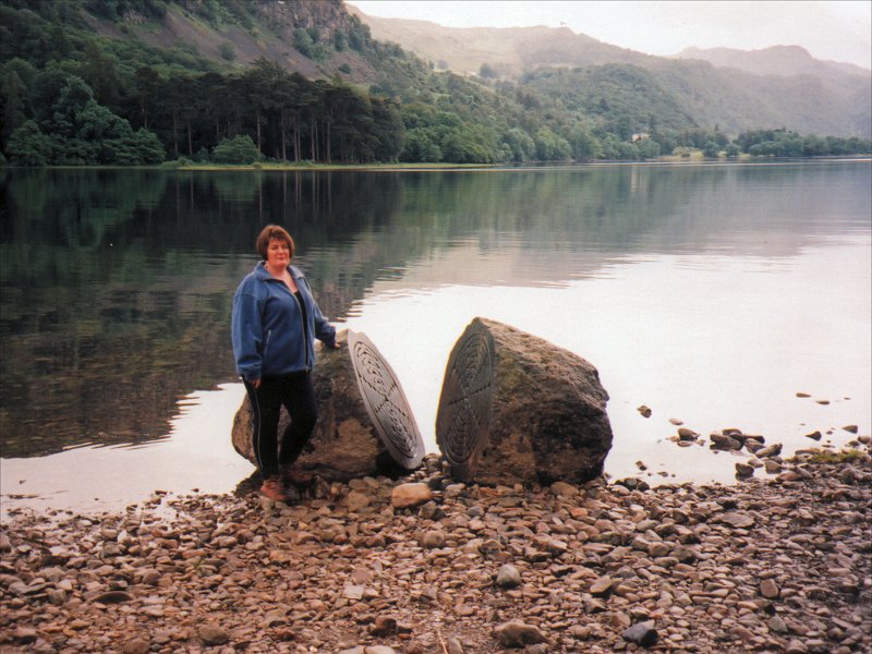 |
We started our honeymoon with a couple of nights in Keswick. The weather wasn't great, but we still managed to have a pleasant walk around Derwentwater; this was a curious boulder that we found on the way. The other highlight of our stay in the Lakes was a trip to Zeffirelli's in Ambleside. For the uninitiated, this is a cinema and vegetarian Italian wholefood restaurant - a perfect combination! Needless to say, we took full advantage of its delights, watching "Attack Of The Clones" and then eating more than absolutely necessary. Bliss! |
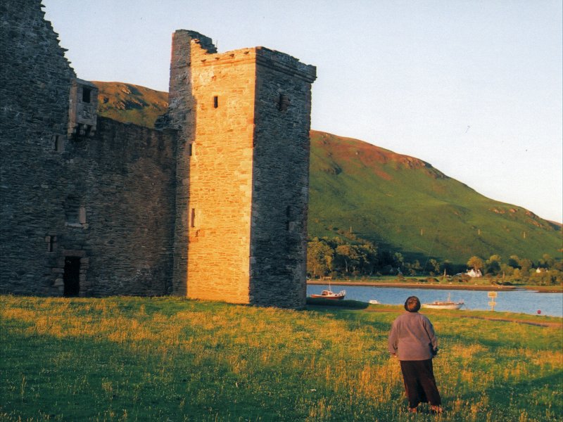 |
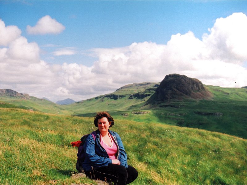
Our next port of call was the Isle of Arran, the most southerly of the Western Isles. We stayed in a delightful B&B (Apple Lodge) at Lochranza, in the mountainous north of the island. Lochranza sits at the head of a deep sea inlet, with this 16th century castle dominating the view. We had a lovely stroll along the coast from here towards the Cock of Arran, then climbed Fairy Dell to return via a higher path, with some gorgeous views. |
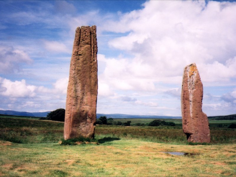 |
The stone circles at Machrie Moor are well worth a visit; this was my third. There are six megalithic circles in reasonably close proximity, all dating from about 2900 BC. While many of the stones are quite small, a number of impressive specimens remain - the tallest of these two stones is more than 5m high! In common with other sites, such as Castlerigg near Keswick (which we also visited), the circles at Machrie Moor are in a spectacular setting, which would be pretty awe-inspiring even without the stones. |
 |
This former standing stone had been carved into a millstone by later denizens, but they seem to have abandoned it when it cracked. The most complete circles were all made of smaller stones like this one, many of them buried beneath the soft earth of the moor. There are also a number of hut circles and singleton stones. |
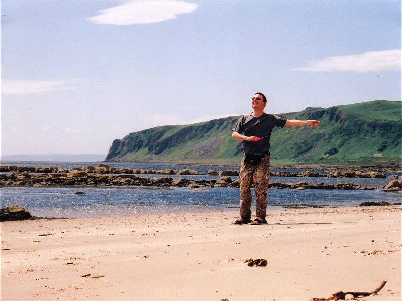 |
This beach, near Kildonan in the extreme south of Arran, was a bit windswept, but that just gave us an excuse to fly our pocket kite, and made the sun seem a bit less fierce. This beach was just down the road from Dippin Lodge, where we and several other chums had an enjoyable week's holiday a few years back. On that occasion, I seem to remember, we spent another ridiculously sunny day on a beach just west of this one. |
 |
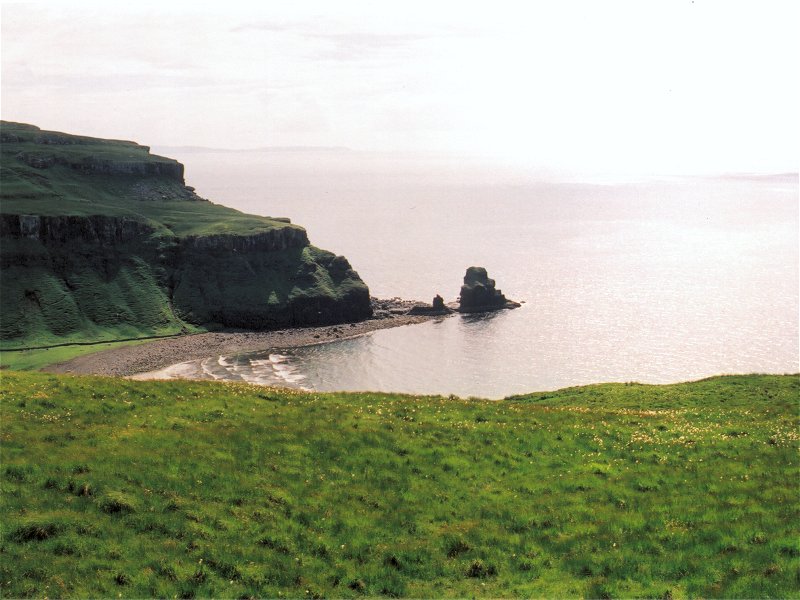
Jura is a wild and sparsely populated island (population 200) with only one significant settlement, called Craighouse. We stayed there, at the Jura Hotel, which is just across the road from the distillery and the general store. Alice spent numerous childhood holidays on Jura, and this beach near Lussagiven in the north of the island was one of her favourite spots. |
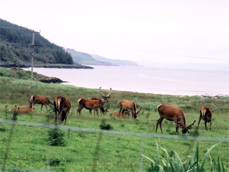 |
The indigenous fauna was a major attraction for us: in our short visit we saw a golden eagle, an otter, seals, buzzards and, of course, lots of red deer (they outnumber the human inhabitants by about 25 to 1). This herd was grazing beside the road, and we later saw a pair of juvenile stags at even closer range, grazing by an inlet on the seashore. |
 |
The flora wasn't bad either. There's a famous walled garden a few miles along the road from from the ferry, but we found more than enough to see along the side of the road. This is an orchid, but most of the flowers that we saw were foxgloves - millions of them! There's only one road on Jura, running most of the way along the eastern coast, before it gives up about halfway into the northern half of the island. |
 |
The Paps are a distinctive group of mountains, which dominate the skyline in the southern half of Jura. They are named for their resemblence to... well, I'm sure you can guess. The west of the island is virtually trackless, and the west coast is famous for its raised beaches and caves. The inacessibility of the majority of the island accounts for the sparsity of its population, and makes it one of the wildest of Britain's inhabited islands. |
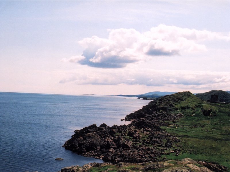 |
We spent most of our one full day on Jura walking around Lowlandman's bay, eventually reaching and climbing the imposing iron age fort at An Dunan. The view south-east from this vantage point shows Islay in the distance. This is where we were lucky enough to spot an otter, swimming in the sea below us, and watch through binoculars as he tucked into a fish that he'd just caught. Magic. |
 |
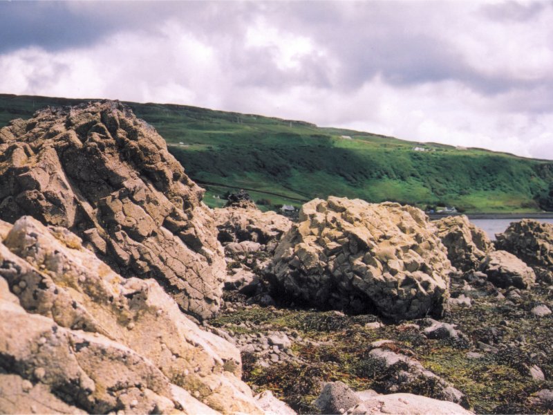
On our way back, we walked along the shore of the bay, tramping through mountains of seaweed and shellfish. This gave us a good look at the colony of seals that spend much of their time in the bay, including this rather contented-looking one, sunning itself on a rock. |
 |
Having indulged in a spot of island-hopping for the first week, we settled down on Skye for the second week of our honeymoon. Once again my immense good fortune when selecting holiday homes had paid off: the view from our gorgeous little cottage across Locj Bay was breathtaking. We soon realised, in fact, that the picture on the front of our pink OS map must have been taken from this very spot! |
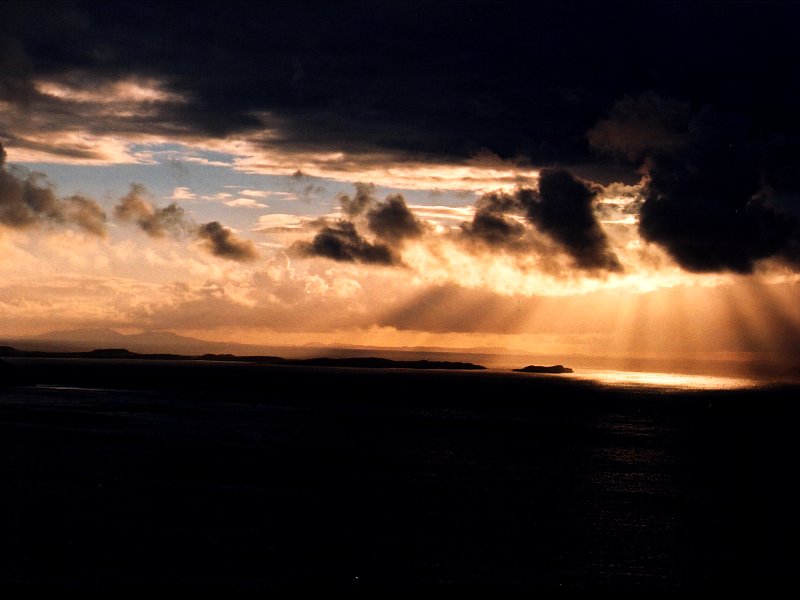 |
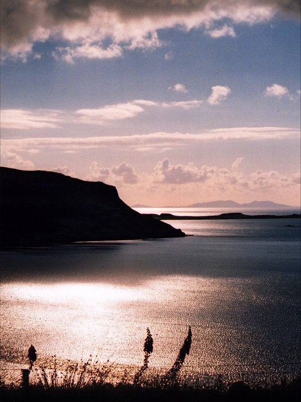
The sunsets here were some of the highlights of the whole honeymoon. The silhouetted shapes of the Outer Hebrides on the horizon looked like the vertebrae of some enormous sea monster, and the rays of the sun were reflected by the sea in dazzling pools of silver and gold. |
 |
The weather at the beginning of the week was a bit grim, and we spent a rather dismal morning in Portree doing some shopping. When we drove over to the other side of the island, however, we found the weather wild but somewhat drier. We enjoyed a bracing coastal walk near Harlosh, stumbling across this superb stack on the way, and were rewarded with magical views of Harlosh island (in the background), illuminated by the sun. |
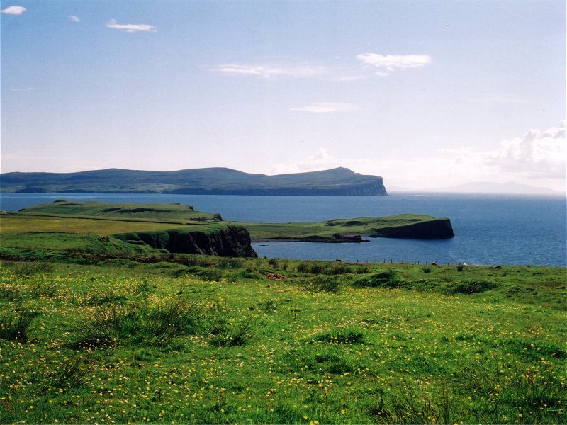 |
Fortunately, the weather took a turn for the better after that. This is the view west from Waternish, the peninsula where we were staying, towards the enormous sea cliffs behind Dunvegan Head on the neighbouring peninsula. To the right, just visible on the horizon, you can see Lewis (or possibly Harris). This was at the beginning of a walk to the ruined settlement of Unish, and we had wonderful views of the Outer Hebrides throughout. |
 |
This is the ruined manor house at Unish, in the far north of Waternish. It was surrounded by the remains of stone croft houses and walls, obvious geometric shapes that stood out clearly from the landscape. It was a grand place for a picnic. We couldn't be bothered to continue on to the lighthouse at Waternish Point. |
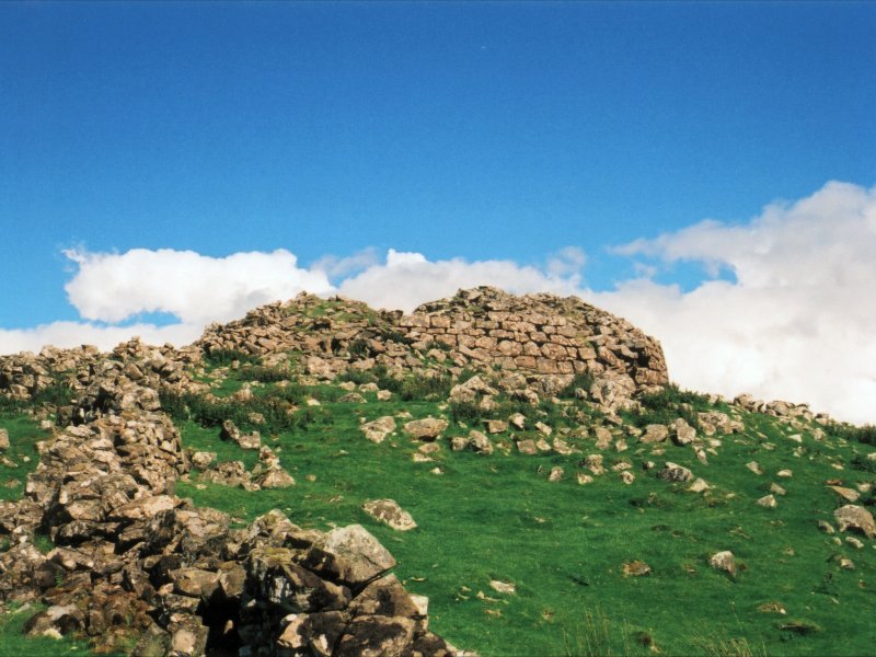 |
On our way back, we spotted a buzzard circling high above this ruined broch. It made itself scarce when we climbed up to the tumbledown remains of the iron age fort, but we didn't mind - there was plenty more to look at. |
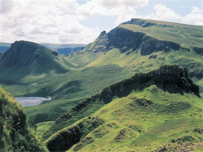 |
Our next trip took us east, to the larger peninsula of Trotternish. Once again the weather was kind to us, with the brilliant sunshine showing off the spectacular geology of the region. We parked high up in the mountains beside a winding single-track road and joined numerous other visitors on a trek through an area called the Quiraing, which features some of the most striking rock formations I've ever seen. |
 |
This pinnacle of rock is a good example. We followed a path along the base of some cliffs, with sheer rock faces and contorted formations looming over us on one side, and breathtaking views across a beautiful landscape towards the sea on the other. |
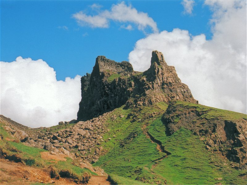 |
This menacing castle of rock is known as the Prison. It stands clear of the main rockface (unseen, to the left), with a rubble-strewn slope spilling out from between them. We climbed the latter, and followed the foot of the cliff round, passing beneath an overhanging rock and catching our first glimpse of the view in the other direction. |
 |
This is me taking a bow in front of yet another amazing rock formation. You don't get much impression of scale here, but trust me: that wall of rock behind me is in the middle distance, and it's frighteningly tall. We walked up the path on the left of the picture and made a small diversion to the right to clamber up onto it. |
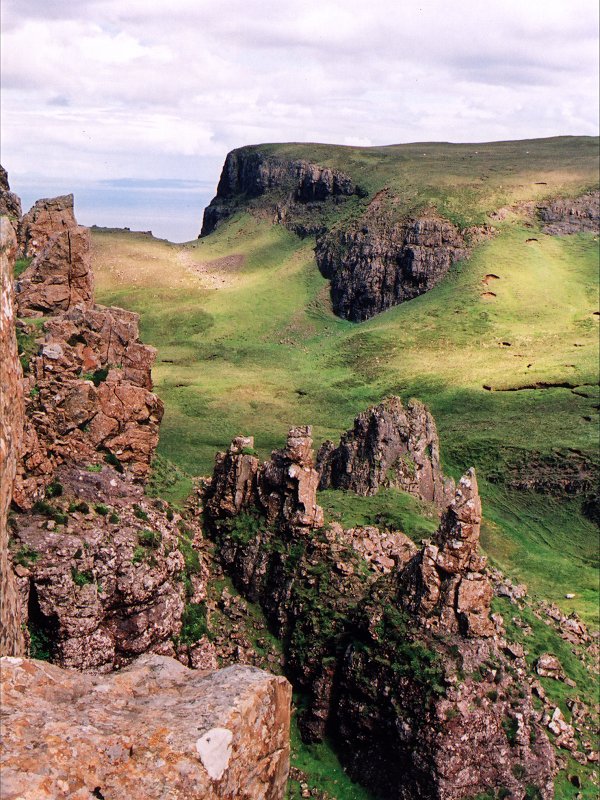 |
This is the view North (right in the previous picture) from the top of that ridge. You can see the sea in the distance, and beyond it, the mainland. After I'd scared Alice silly by leaning over to take this picture, we walked back along the top of the cliffs we'd followed on the way out. It was very windy and Alice was too vertiginous to walk along the edge of the cliffs, so we kept our distance, and eventually found our way back to the car. |
 |
The weather was a bit more variable for our next walk, but it stayed mostly dry, with the sun frequently breaking through clouds. We drove down to some beautiful high moorland in the in the west of Skye. On the way, we were treated to views across Loch Bracadale to Idrigill Point, and the stacks called Macleod's Maidens, which we'd visited on a previous trip to Skye. |
 |
The walk across the moors was damp underfoot, but mostly firm. Bog-cotton grew in abundance and we found a number of small pools amongst the hills on the high plateau. Our path eventually took us to the edge of a beautiful green valley, but rather than descend into it, we followed the ridge to a high vantage point looking down on Talisker Bay. |
 |
Just up the road from our cottage was the village of Stein, originally designed by Thomas Telford and the site of Skye's oldest inn, which dates from the 17th century. We found some interesting bits and bobs in a craft shop there, then walked on the pebbled beach. The remains of Telford's pier were there, and so were numerous strange rocks and a curious stone pavement. |
 |
The last night in our lovely cottage finally arrived, and we used up our remaining films photographing the sunset. We were sad to leave it behind, but we couldn't really have asked for a better place to stay, or a better honeymoon. One thing is certain: we'll be back... |